St. Regis, Quebec
For more than 150 miles east of St. Regis, the 45th Parallel marks the international boundary between the United States and Canada, as well as between New York and Quebec. This line from the Connecticut River to the St. Lawrence River was first charted by surveyors John Collins and Thomas Valentine from 1771-1774. Later, the 1783 Treaty of Paris at the end of the Revolutionary War defined the border between the United States and Canada here as the 45th Parallel, following their survey, known as the West Line. Due to the primitive equipment and the harsh frontier conditions of the time, the line marked by Collins and Valentine meandered inaccurately north and south of the 45th Parallel. Most notoriously, the survey line near the east side of New York at the shore of Lake Champlain was marked three quarters of a mile north of the actual 45th Parallel, so that a large fort built there to defend the border was discovered to have been built on Canadian territory. "Fort Blunder" was abandoned and for many years the border remained inexact until the 1842 Webster-Ashburton Treaty settled the boundary as the previously-established wavering survey line, mistakes and all, rather than the mathematically-exact 45th Parallel line as originally intended.
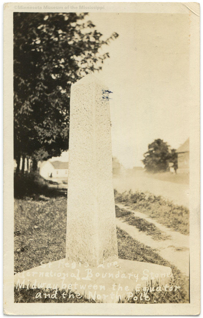
The International Boundary Commission is a joint U.S.-Canadian organization charged with marking the border between the two countries with monuments and maintaining a 20-foot wide swath of cleared land the length of the five thousand mile line. The length of border following the 45th Parallel is marked with hundreds of stone obelisks such as the one in the antique postcard above. The stone pictured is likely the westernmost of the markers, as just west of St. Regis the border turns south to follow the channel of the St. Lawrence River.
St. Regis is an exclave on a peninsula in the St. Lawrence river not accessible by land from Canada, but this is less of an inconvenience than it might seem because the town lies within the St. Regis Mohawk Reservation (also known as Akwesasne), which straddles the border and whose sovereignty supersedes the boundaries of the U.S. or Canada to many locals. Indeed the stone boundary markers such the one in this postcard are nowadays neglected and disregarded, used as fenceposts or lost in overgrown brush. Within the reservation the Boundary Commission no longer clears the 20-foot wide swath which serves as a visible reminder of the border. In St. Regis, numerous houses are built across the boundary line, and people and traffic cross freely. Imaginary political borders and imaginary lines of latitude have less meaning to a people more interested in guarding their own identity against larger powers.
View 45th Parallel Markers in Google Maps