|
|
Stone Faces Gazetteer
Faces - Ciff Profiles, Boulders, Outcrops
Alabama
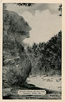
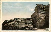
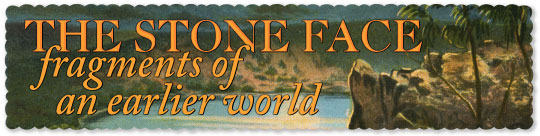
Indian Head Rock
Dismals Canyon
Located in Dismals Canyon National Natural Landmark (a privately-owned park) along with other formations like “Fat Man’s Misery” etc.
 N 34° 19.494', W 87° 46.930' N 34° 19.494', W 87° 46.930'
|
Indian Stone Head
Natural Bridge
|
 |
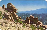
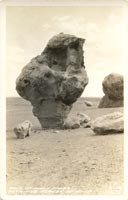
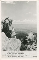
Arizona
California
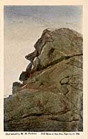
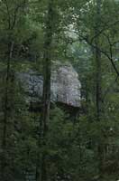
Old Man of the Rocks
Calistoga
|
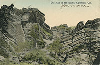 |
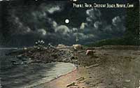
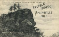
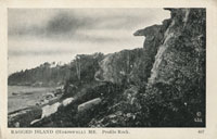
Profile Rock
Camp Meeker
|
 |
Indian Head Rock
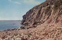
Catalina Island
Cliff profile overlooking sea.
N 33° 22.705', W 118° 28.841'
|
Indian Head Rock
Chatsworth, Iverson Ranch
In area where Lone Ranger episodes were filmed. See photos.
N 34° 16.408', W 118° 36.728'
|
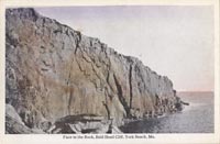
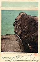
The Face in the Rock
Dana Point Headlands
Cliff profile looking out to sea from tip of Dana Point just above surf line. Photo
N 33° 27.628', W 117'° 42.448
|
Indian Head Rock
Jenner, Timber Cove
Cliff profile visible from Timber Cove boat landing
MNM#01-01381
N 38° 31.955', W 123° 16.480' |
 |
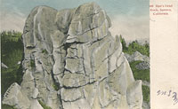
Profile Rock
La Jolla
Sedimentary sea stack most likely at Point Loma
MNM#01-01326
|
 |
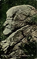
Old Man Rock
Los Angeles, Mt. Wilson
|
 |
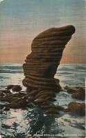
Pompadour Rock
Mt. Tamalpais
|
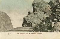 |
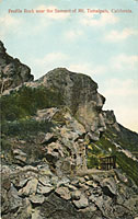
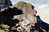
Profile Rock
Mt. Tamalpais
|
  |
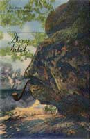
The Old Stone Face
Napa
|
 |
Lincoln's Profile
Palm Springs
A reclining profile on a foothill of Mt San Jacinto, best visible from a charming public telescope behind the Henry Frank Arcade
N 33° 49.511', W 116° 33.263' |
|
Stone Face
Palm Springs |
|
Flat Head
Santa Monica
Rock outcrop on old postcard next to the Roosevelt Highway looking out to the ocean. The road was renamed the Pacific Coast Highway in 1941. Most likely the rock was demolished to enlarge the roadway.
|
Man's Head Rock
Sonora
|
 |
Abraham Lincoln
Trona, Salt Wells Canyon
When traveling west through the canyon, at one point on the north wall an outline of the rocks closely resembles the profile of Abraham Lincoln.
|
Profile Rock
Truckee River
|
Colorado
The Grandmothers
Austin Park |
|
Lincoln Face
Bear Creek |
|
Old Man of the Snowslides
Big Bell Lake
|
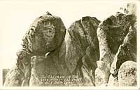 |
Profile Rock / Rocky Mountain Joe
Boulder Canyon
|
 |
Sorrowful Satan
Cheyenne Canyon
|
 |
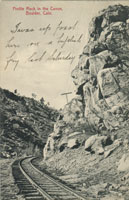
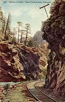
Mother Grundy
Clear Creek Canyon
Formation was likely destroyed when US 6 was built throught Clear Creek Canyon over the railroad line in 1941-1952.
MNM#01-01168
MNM#01-01184
|
  |
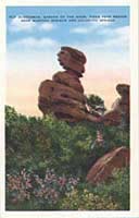
Old Scotchman
Garden of the Gods, Colorado Springs
This formation is also often referred to as "Harry Lauder" after the popular comedian of the early 20th century.
MNM#01-01038
N 38° 52.359', W 104° 53.083'
|
 |
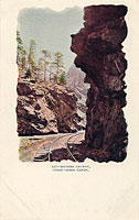
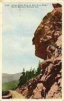
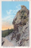
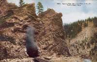
Indian Profile Rock
Grand Lake
Profile of a face with "feathers" standing upright above, accidentally created around 1918-1920 by workers dynamiting an outcrop for the one-lane Fall River Road from Milner Pass down to Grand Lake. About a decade later, the current Trail Ridge Road was built higher above the outcrop.
Apparently the profile still exists overlooking the old roadbed a mile south of Poudre Lake, or about halfway between Fairview Curve and Milner Pass.
MNM#01-01137
MNM#01-01396
N 40° 24.603', W 105° 49.188' (Approximate location) |
  |
Indian Head Rock
Manitou Springs
|
Sphinx Head Rock
Moffat Road
|
 |
Indian Head Rock
Ohio City
|
|
Human Face
Ouray
|
 |
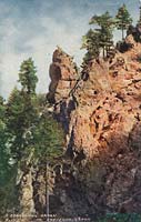
Profile Rock
or Old Man's Face
Poudre Canyon
|
 |
Profile Rock
Rustic
Located in Front Range, northern Colorado.
|
Indian Head Rock
San Luis Valley
Unknown location in San Luis Valley
MNM#01-01388 |
 |
Profile Rock
Spanish Peaks / La Veta
|
Lady of Flirtation Rock
Wray |
|
Connecticut
Georgia
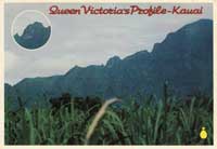
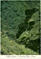
Hawaii
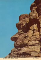
Idaho
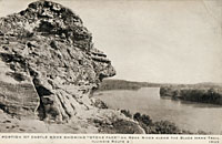
Illinois
Indiana
Iowa
Kansas
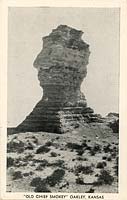
Old Chief Smoky or The Sphynx
Oakley
|
 |
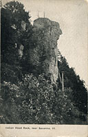
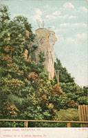
Indian Head Rock
Quinter
Also known as "Cobra Rock", it has since fallen - photo
|
Kentucky
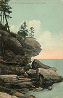
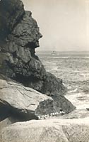
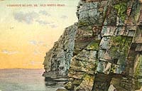
Maine
Massachussetts
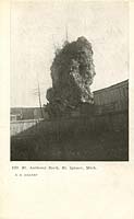
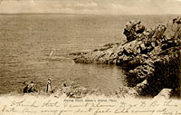
Norseman
Baker's Island
Known variously as "Norseman," "Man of the Sea," or simply "Profile Rock." It is a fully formed head sprouting from the rocky shore just north of the Bakers Island lighthouse.
MNM#01-01292
N 42° 32.2267', W 70° 47.1769'
|
 |
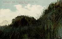
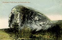
Washington’s Profile Rock
Baldwinsville
|
 |
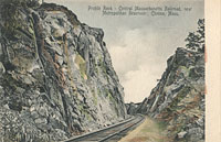
Profile Rock
Clinton
Located in a railroad cut along Central Massachusetts Railroad, near Metropolitan Reservoir.
MNM#01-01286
|
 |
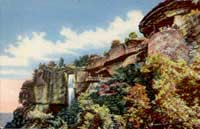
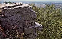
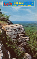
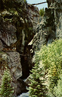
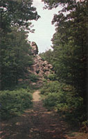
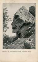
Profile Rock or Old Man of Joshua Mountain
Freetown
A well-known profile on a 50-foot rock outcrop in Freetown State Forest. Easily accessible to hikers and graffiti artists.
MNM#01-01110
MNM#01-01276
N 41° 47.751', W 71° 03.217'
|
  |
George Washington Profile
Gloucester, Eastern Point |
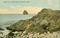
Old Mother Ann
Gloucester, Eastern Point
|
 |
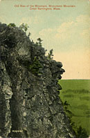
Old Man of the Mountain
Great Barrington
|
 |
Great Stone Face
Melrose
|
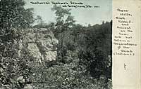
Old Man of Middlesex Fells
Middlesex Fells
This boulder profile was located in the forest of the Middlesex Fells Reservation near the junction of Fellsway and Parkway Road. It may have been displaced or destroyed by construction of Interstate 93.
MNM#01-01260
|
 |
Indian Head
Mohawk Trail
Unknown location along the Mohawk Trail, an early auto highway through the Berkshires which opened in 1914. Most likely this formation (not very identifiable in the photo) was destroyed when the road was later widened and modernized.
MNM#01-01234
|
 |
The Old Man of the Rocks
North Scituate, Minot Beach
|
 |
Profile Rock
Onset Bay, Shell Point
|
 |
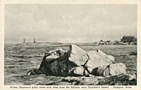
Father Neptune
Rockport
|
 |
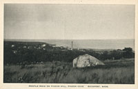
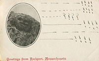
Profile Rock
Rockport
Boulder on Pigeon Hill.
MNM#01-01288
|
 |
Rock Face
Rockport
|
 |
Stone Face
Rowe
|
 |
Nubian Head Rock
Scituate |
|
Old Man of the Valley
West Chesterfield
|
 |
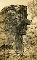
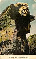
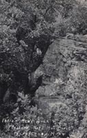
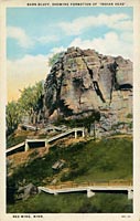
Michigan
Minnesota
Montana
Old Man of the Canyon
Butte
|
 |
Indian Head Rock
Chouteau |
|
Indian Head
Gallatin Canyon
MNM#01-01313
|
 |
Indian Head Rock
Glendive (Pinnacle Park) |
|
Nevada
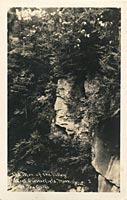
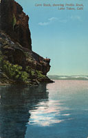
Lady of the Lake or Old Man Face
Lake Tahoe
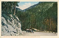
Cliff profile at the base of a volcanic plug sacred to the Washoe Indians. The hanging bridge and roadway in the postcard image were built above the face in 1863, later replaced by tunnels through the rock with construction of the Lincoln Highway in 1931. Despite the label on the card, the profile is located on the Nevada side of the lake.
MNM#01-01291
N 39° 2.780', W 119° 56.935' |
 |
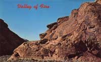
George Washington
Moapa Valley, Valley of Fire State Park
Reclining profile of George Washington
MNM#01-01393 |
 |

|